Tuesday 6 December 2011

Redesign

I'm preparing a complete redesign of the site. Here's how it looks now:


...and here how it will look in a few days:

Monday 21 November 2011

Online GPS Route Editor [screencast]

What's the difference between "GPS Route" and "GPS Track"?

  • A track is a collection of points of a path you actually made in real life. Track points contain GPS coordinates, time when it is recorder, the elevation of the point, ...
  • A route is a collection of points of a path you didn't made in real lif, but plan to. Route points don't contain elevation and time. Routes usually contain less points than tracks but may be helpful when you organize your future outdoor activities.
Now, Trackprofiler has a new option to create, edit and organize routes. You can see here a quick screencast on how it works:

Tuesday 8 November 2011

Announcement: Route editor

An early screenshot of the new feature; route editor:


+ edit routes based on one or more (multi-layered) tracks.

Later this month.

Monday 10 October 2011

Metric or US system for GPS track data

This month -- the option to switch from the metrics system (meters, kilometers, ...) to the US customary system (miles, feets) for every track. Just go on any track, select "Units" (top right) and select the system you want.

Alternatively, edit your profile and (un)check the "Use US/UK metrics (miles, feets, ...) when displaying track data" checkbox.


Thursday 15 September 2011

Next-previous point

When you to edit the location on the track, now there are two new options that allow to more accurately choose the point. Till now you had to click near the track and hope that you clicked near the right point (in fact -- the nearest point will be selected).

Now, after you selected the location, you can move to next or previous point on the track, and then edit it as you want:


Thursday 1 September 2011

Better search

Little by little, I'm uploading my entire archive of GPS tracks on TrackProfiler. But, as the collection grows, searching all tracks became harder. But, with the new search option is now much easier:


When you are logged on the site, you can decide if to search your own (public and draft) tracks or only public ones.


Thursday 25 August 2011

Move GPS graph up/down

Last time in Ližnjan, we took a short walk. But, if you look closely at the resulting graph -- there is something wrong:


At the lowest point of our walk we were walking near the sea. So the lowest point should be zero. Instead, my Android phone measured the elevations completely wrong. In fact the entire track is 38 meters higher than it should be. I still don't know why, but sometimes smart phones get the GPS elevation completely wrong.

No problem, there is a new option to fix this. Just go to the "Elevation errors" tab, click on "Move graph up/down", and select the amount of vertical elevation change:


For example, I entered -38m (meaning: "Do move the entire graph 38 meters lower than now").

The result is:


PS. Thanks to Bill Casey for the suggestion!

Wednesday 24 August 2011

Upload GPS tracks by email

When mountaineering, I use my old Garmin GPS60. But, for short walks or bike trips, I record them on my Android with MyTracks app. A friend of mine asked me why I don't make an Android/iPhone app so that he would be able to upload tracks directly from his smartphone.

But working on two apps (iOS and Android) is a hassle. But, there is a solution! Even without the smartphone application! It is easy... Login on 
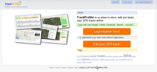
trackprofiler, go to  " Upload by email" tab. Copy-paste the email address from the page...


...in your favorite mail client. And voilà!

Next time outside, after you have recorder your track just send an email to this address. The email must have attached the GPX file with the track. The track will be parsed and uploaded directly to Trackprofiler.

Tuesday 23 August 2011

New icons

New version, lots of small bug fixes, one cosmetic change:

Icons before:


Icons now:


...and one important new feature: Upload tracks by email. More on this later.

Tuesday 12 July 2011

Edit and upload track without registration

Just upgraded to a new version. You'll find out instantly that there is something new... The main page now looks like:


But the main difference is that now you don't need an account to upload, edit and share a GPS track. Just click on "Edit you track" and go... You can register later. You can merge this uploaded track with your existing account...

But you don't have to. It's up to you!

Tuesday 5 July 2011

GPS track errors

Another small feature is rolled out; if your track has GPS measurement errors they may be elevation or latitude/longitude.

For elevations it was easy -- uplad your track, go to "Elevation smooth" tab, click "Remove extreemes" and voila -- all elevation errors are gone. But for position (i.e. latitude/longitude) there wasn't this option. At least till now.

And, by the way, the algorithm for GPS elevation errors detection is now much better.

Tuesday 21 June 2011

Lots of new stuff

Lots of new stuff last weeks. OK, mostly not so visible, but anyway...

New features:
  • Now, if the image is GPS geocoded it will automatically be positioned on the map
  • The elevation graph -- if you have too many elevation extremes (probably because of measurement error) now you can decide to delete them all at once. The app will proceed to find them all and remove them. 
Minor bug fixes:
  • If the waypoint was positioned near the end of the graph now it will be visible on the graph.
Comming soon:
  • Upload/edit GPS track even without registration.
  • Automatic detection of the points where you were stopped on the track and conversion of those points to waypoints.

Monday 9 May 2011

Trackprofiler private beta to be launched

OK, I'm almost ready. Now, the list of editing options for tracks is:

  • Join tracks,
  • Split tracks,
  • Move single points,
  • Remove single points,
  • Split track segments,
  • Remove track segments,
  • Smooth (i.e. remove GPS elevation errors),
  • Add/edit/remove single waypoint,
  • Remove all waypoints,
  • Move entire track.
I completely changed the way how track editing (point by point) and track segment editing works. It should be easier now. 

The last things before launching the private beta are in the process. Hope it will be ready during the next week. So, stay tuned ;)

Sunday 13 March 2011

Image positioning

Image positioning on the track was one of the more problematic options of TrackProfiler. I say "was" because it should be way easier now. The new layout looks like:


If the image position can't be found -- the photo won't be shown on the map and You'll get a message about it.

And, by the way. Photos aren't correctly geopositioned when the camera time wasn't synchronized with the GPS time. When you upload and position your first photo -- TrackProfiler will memorize the "correction time" and all the following images on the same track should be OK.

Monday 7 March 2011

Edit GPS track point by point

A quick screencast of the new "edit track point by point" feature on trackprofiler. Still not 100% complete (must make it faster), but it is usable:


PS. This is my first screencast, hope You like it.

Sunday 13 February 2011

New layout for track pages

Just uploaded a new version. With some minor bug fixes the biggest change is a completely different layout of the GPS track page. Here's how it looked before:


...and here is the new version:


There are still a few quirks to be fixed, but the main layout is ready.

Hope You like it.

Thursday 20 January 2011

Moving/stopped GPS track stats

Just rolled out another small feature. Look at the stats column right of the map for your GPS track:


The new fields are:
  • Time stopped,
  • Total time ( = time moving + time stopped ),
  • Total speed ( = speed for entire duration of the track, including stopped time ),
  • Time moving.

Sunday 16 January 2011

Tag cloud

Another small feature added. Trackprofiler now has a "tag cloud" page:


...at the moment the biggest tags are members of my family :) but I expect they will become smaller as more people will register and upload their tracks.

Friday 14 January 2011

Reset GPS track

Now that Trackprofiler has many ways of editing the track (images, waypoints, smoothing, joining segments, deleting segments, change segments order, moving track) -- it may happen that you make an error. What then? Till now -- you had to delete the track, upload a new (same) one and do all your changes once again (but without the erroneous one, of course ;).

Now, there is a new option -- "Reset track". By reseting the track it will return to its original file -- the one you uploaded without other changes you made. Check the "Reset" tab on the track page (after you sign on)...


PS. Images will survive the "reset" process.

Wednesday 12 January 2011

New Trackprofiler logo

Design is definitely not my best side. But I never stopped trying (maybe I should :). So, here's the result of playing with inkscape today -- new Trackprofiler logo:

Tuesday 4 January 2011

Happy new 2011

I wish you all a happy new 2011!

PS. I like prime numbers, and 2011 is one of them. So, hope that this will be a very good year for me (and trackprofiler.com :)